Your Gateway to Spatial Solutions
Call/WhatsApp +92 345 2997342
ER Solutions specializes in the creation of various digital elevation models using satellite imagery. Whether you need contour maps, modelling services, or visualization solutions, we are confident in our expertise and experience to fulfil all your elevation requirements.
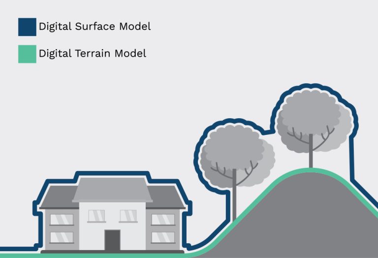
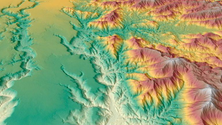
Digital Elevation Models (DEMs) play a crucial role in geospatial analysis. A DEM is a digital representation or 3D model of a terrain’s surface, generated using 3D data. At Geoimage, our internal processing team can provide two types of DEMs (DSM or DTM) for your satellite imagery, based on your specific needs.
This type of DEM depicts the Earth’s surface and includes all objects present on it. It incorporates the heights of cultural features like buildings, roads, and vegetation, as well as the bare ground.
This variant of DEM represents the bare ground surface with all cultural features, such as buildings and trees, removed.


Urban Planning

Hydrology

Environmental Studies

Vevil Engineering

Forestry

Agriculture

Based on your specific needs and the project’s requirements, We will suggest a suitable DEM solution. We offer DEMs that can be generated from either Stereo or Tri-stereo imagery.
Additionally, we can provide AW3D from RESTEC and WorldDEM™ Neo from Airbus as an alternative option.
Image ProcessingMost types of raw satellite imagery require some type of geometric correction or rectification so that the image corresponds to real-world
DEMER Solutions specializes in the creation of various digital elevation models using satellite imagery. Whether you need contour maps, modelling services, or